


BATAVIA 16 Voting District, Kane County, Illinois
About
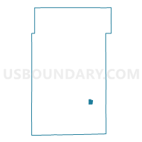
Outline

Summary
| Unique Area Identifier | 571672 |
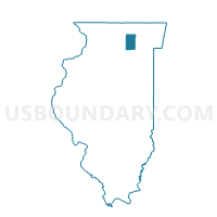
| Name | BATAVIA 16 Voting District |
| County | Kane County |
| State | Illinois |
| Area (square miles) | 0.85 |
| Land Area (square miles) | 0.82 |
| Water Area (square miles) | 0.03 |
| % of Land Area | 96.28 |
| % of Water Area | 3.72 |
| Latitude of the Internal Point | 41.83402260 |
| Longtitude of the Internal Point | -88.33312500 |
Maps

Graphs
Select a template below for downloading or customizing gragh for BATAVIA 16 Voting District, Kane County, Illinois


Neighbors
Neighoring Voting District (by Name) Neighboring Voting District on the Map
- BATAVIA 10 Voting District, Kane County, IL
- BATAVIA 11 Voting District, Kane County, IL
- BATAVIA 21 Voting District, Kane County, IL
- BATAVIA 7 Voting District, Kane County, IL